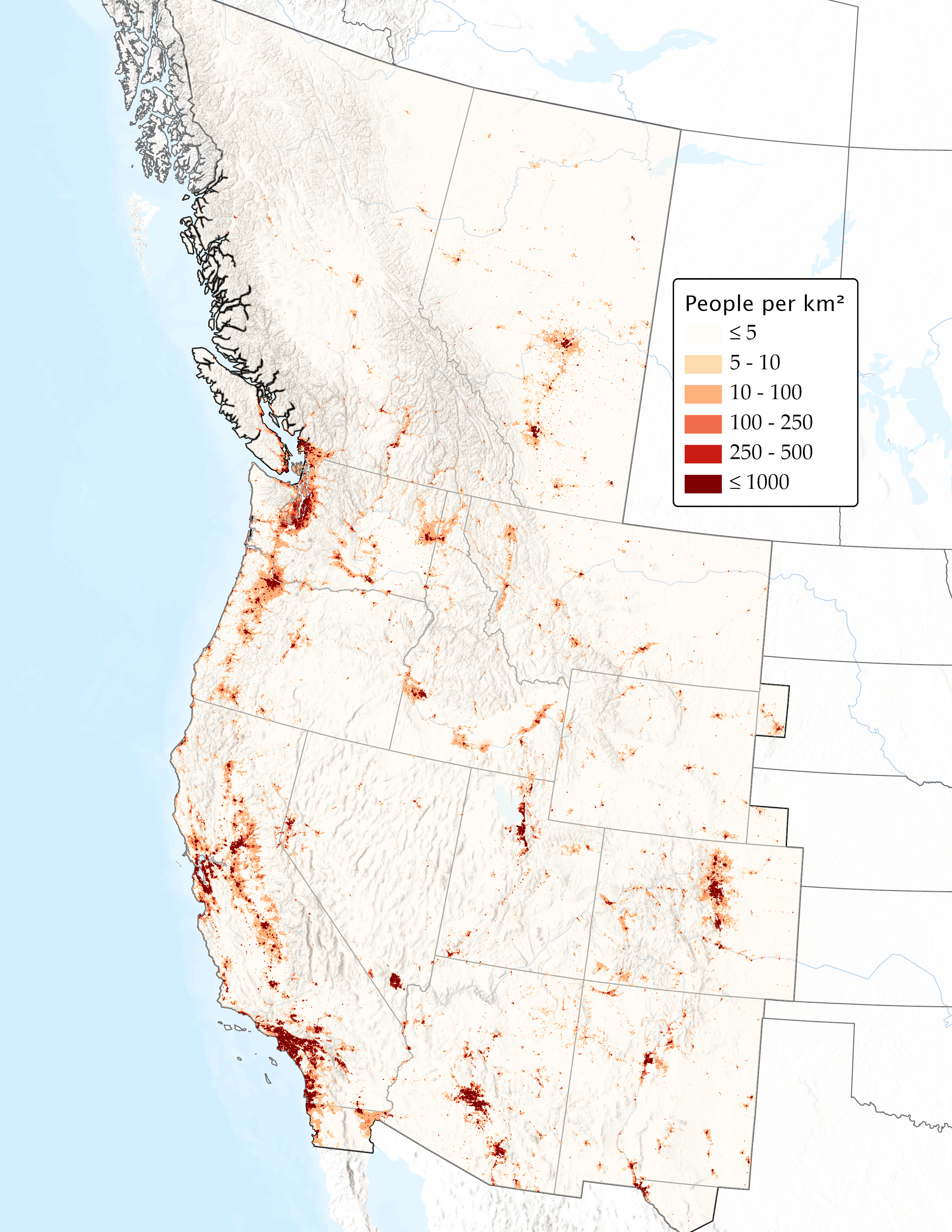
The Western Interconnection serves a population of over 80 million people. The interconnection spans 1.8 million square miles in all or part of 14 states, the Canadian provinces of British Columbia and Alberta, and the northern part of Baja California in Mexico. Due to the unique geography, demography, and history, the Western Interconnection is distinct in many ways from the other North American interconnections.
Operations and Planning
The interconnection has undergone significant changes over the years. In 2019, the interconnection shifted from being served by two RC to four, with the expansion of the SPP RC into the West and the creation of the BC Hydro RC and RC West. Historically, there has been less reliance on market structures than there is currently. Since 2011, there has been a gradual expansion of market participation by BAs, with a majority of Western BAs participating in either the CAISO EIM or the SPP EIS.
Transmission
The Western Interconnection is made up of about 136,000 miles of transmission lines. Two features distinguish the flow of electricity in the West from that in the East:
• Long, high-voltage lines were built to connect remote
generating resources with distant population centers, primarily along the West Coast.
• Other lines carry power from hydroelectric resources in the Pacific Northwest to California and other states. These resources have the greatest capacity during the spring and summer, when demand in the Northwest is relatively low. This allows utilities there to sell a great deal of excess power.
Because of these unique supply-and-demand patterns, utilities in the West rely more heavily on electricity transported over long distances than utilities in the East. Electricity generally flows south and west in a "doughnut" pattern, rather than the typical spiderweb pattern of the East.
Geography and Land Use
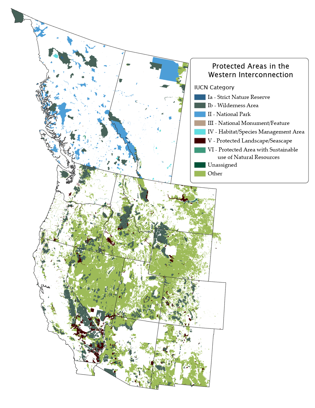
Nearly 87% of the Western Interconnection is public or protected land, compared to just 27% in the combined Eastern, Texas, and Quebec interconnections. These protected areas present more challenges when planning the system, including the protection of vulnerable species, habitats, and vegetation; and the preservation of game rangeland, migration corridors, and critical rivers and streams. There are also cultural considerations when planning the system, including Native American tribal lands and sacred sites, national parks and monuments, and state parks.
2022 Wildfires
While each interconnection faces a variety of environmental risks to reliability, the Western Interconnection regularly experiences large wildfires in northern California, the Pacific Northwest, and Canada, threatening the reliability of the BPS. Comparatively smaller wildfires near major population centers that intersect with narrow corridors of high-voltage transmission lines also present a unique reliability challenge in the West. This interactive map shows significant wildfires across the West over the last year.
For details on current wildfires, see WECC's Interactive Current Wildfire Dashboard.
